
|
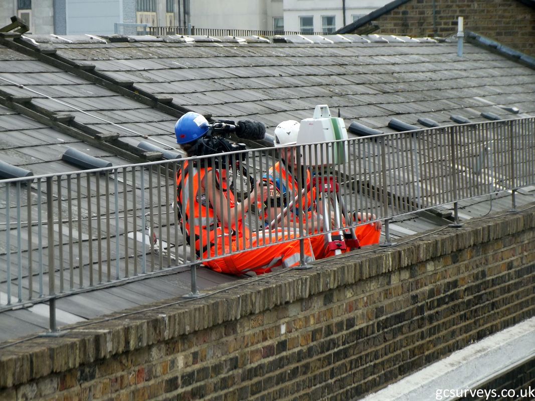
Scour surveys are imperative for the Rail Industry to keep their infrastructure in full working order. Often, damage or wear and tear to assets such as railway bridges can go unnoticed if it is below the waterline, so surveys need to be carried out to assess the damage and make recommendations for repair. In order to gain a clear picture about the health of a railway structure such as a bridge, a Scour Assessment Survey is needed. The survey will be conducted across various parts of the bridge as well as upstream and downstream of the structure. The survey will produce upstream and downstream cross sections, bed levels and photographs to enable hydrological models, depth and flow velocities to be calculated. 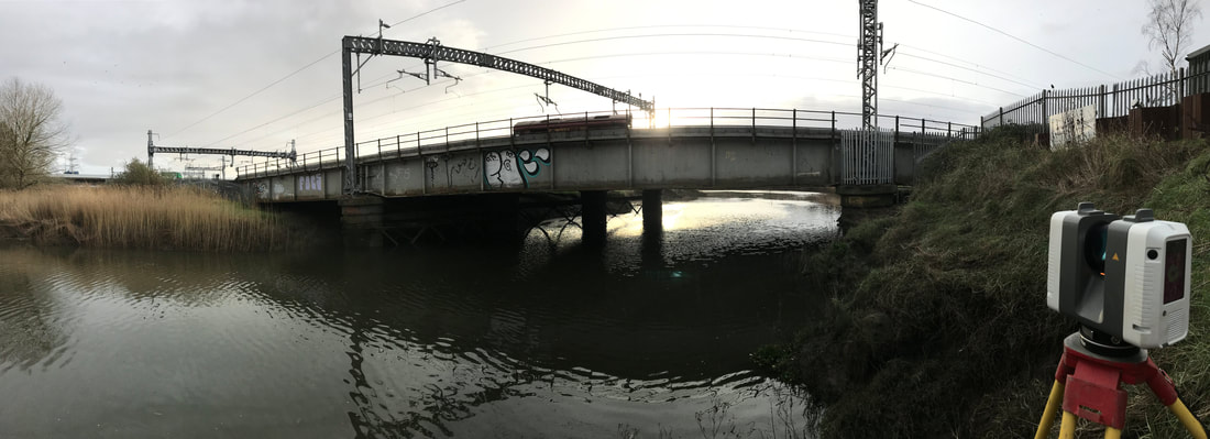 The results of this survey will produce an ‘at risk’ rating of low, medium or high and, if medium or high, a more extensive Scour Protection Survey may be required in order to inform the repairs that will need to be made to the bridge. This Scour Protection Survey is designed to be more in-depth and will include upstream and downstream elevations/cross sections, full Topo of bed levels, location of any coring, hydraulic modelling of the watercourse and photographs. Unlike land or building surveys, scour surveys are more complex because data needs to be collected above and below the waterline, which involves the use of a number of pieces of equipment and diversely trained Surveyors. 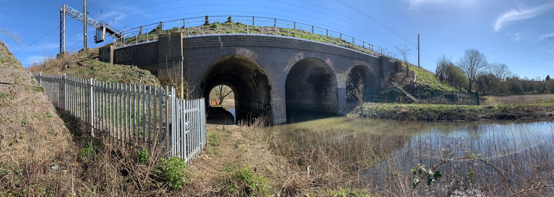 At Grantham Coates Surveys we have years of experience in conducting surveys for Scour Protection and our team are trained to carry out surveys in conditions that can be tricky and ever-changing. We use the latest laser scanning technology to collect bridge elevations, abutments and pier details quickly and effectively, whilst our boat team can be deployed with an underwater sonar to capture point cloud data of the bed levels and everything that cannot be seen just by wading; such as submerged posts, undercutting of abutments and bed materials. 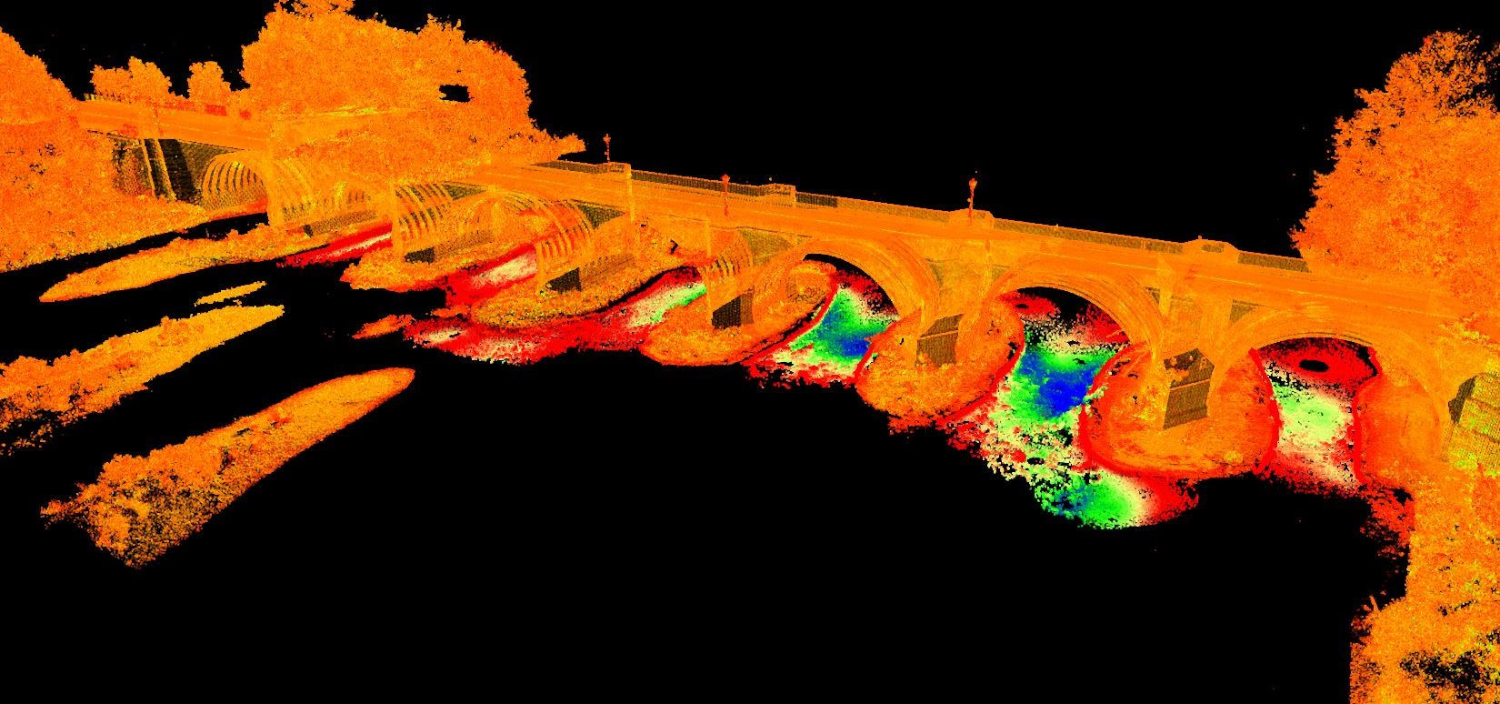 When the Scour Protection is complete, the data is used to create detailed 3D drawings of the state of the bridge above and below the waterline so that design and build work can be informed and planned. Without Scour Assessment and Protection Surveys, damage to rail infrastructure caused by flooding and unpredictable weather could go completely unnoticed until it is too late, so form an essential part of rail infrastructure maintenance.
0 Comments
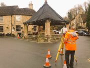
Last year we decided that using a drone to bolster our surveying services would be a good idea, so we set about applying for a license. We knew that the application and training process wouldn’t be a walk in the park, but nothing really prepared us for the time, effort and investment we would have to make in order to get our approval from the Civil Aviation Authority. As we want to fly our drone commercially (in other words for a fee) then we have to prove that we are not only competent to fly a drone, but that we are willing to take on the responsibility of being in charge of a UAV and deciding whether or not it is safe to fly without being a danger to anyone or anything in the area. The training we undertook included theoretical and practical exams, hours of flying time and awareness tests. We had to complete a complex operations manual and seek approval from the CAA, and only then were we able to achieve our Permission for Commercial Operation (PfCO). Since then we have adopted parts of the ops manual into our current risk assessments that we have for every job we do, so we are constantly adapting our processes and weighing up factors such as weather and safe launch areas for every flight. So how do you go about finding a CAA approved Drone Pilot? Anyone that flies a drone for ‘commercial gain’, is breaking the law if they do not have the right license. Without this they cannot obtain the right insurance, so if anyone gets hurt in the process then there is no policy in place to cover the unthinkable. We are accredited and insured, anyone who can’t say the same is not legally allowed to fly. A commercial pilot will be listed with the CAA so their website is the best place to look, or you can search the Drone Safe Register by location to find your local pilot. Once you find a pilot and drop them a line, you should expect them to ask you a number of questions about your project, as they will be deciding whether or not they can take it on. Once they have established the type of location, the risks, the equipment they might use and the legal requirements, only then will they be able to send you a quote. Taking responsibility for their own equipment and the safety of anyone in the immediate vicinity should be top of your drone pilot’s list, so choose one who is compliant, safe and accredited. If you have a project in mind that may benefit from drone input, get in touch with us today on 01789 764420. At Grantham Coates Surveys we carry out topographic surveys in all manner of environments and were recently commissioned to carry out surveys on numerous hectares of forest. The deliverables here were standard topographic 3D surveys showing all trees over 300mm, but knowing from experience that these types of surveys can often be extremely time-consuming, we decided we needed to find a way of speeding up the process in order to avoid extended project timescales and thus higher fees. Proudly we regularly evaluate our workflows, equipment and technology to continually improve our working practices, and decided to run an experiment to see how we could speed up a forest scan without compromising on the quality of the data. We therefore compared standard terrestrial laser scan data from a previous 30 hectare forest survey in 2018, with a sample collected in our local forest with the new GeoSlam Horizon handheld scanner. Not only did the GeoSlam Horizon have a greater range, but with the assistance of James Philips from Korec we discovered that the data collected also had reduced errors across the area being of the order +-20mm. The result of this meant that using the GeoSlam Horizon and a combination of GeoHub, Cyclone and LSS Point Cloud to process the data into a full 3D topographic survey, would take less time and therefore at a lower cost to our client. Using the GeoSlam Horizon enabled us to provide a forest survey that contained more information than could be captured using more traditional methods. We achieved:
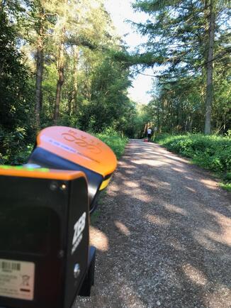 GeoSlam Horizon in action! 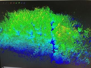 One Zeb Horizon data set. All captured from hand held ground level scanner.  Our location in the forest during the scanning process.
At Grantham Coates Surveys we pride ourselves on continually innovating, developing and investing to stay both current and ahead of the field in all aspects of land surveying. To this end we have trained two UAV drone pilots and gained the all important CAA license to enable us to fly commercially. We see UAV surveys as another tool in the box. UAV’s along with our laser scanning, sonar scanning and traditional survey tools make us well placed to carry out any survey anywhere in a timely, safe and cost effective manner. UAV surveys provide a remote controlled platform from which low level imagery can be captured. Some of the advantages of UAV surveys are:
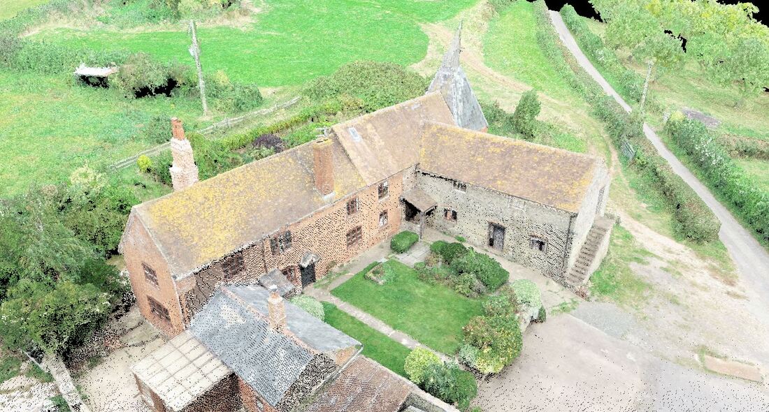 Above: Farm complex UAV Survey UAV Survey of railway embankments. Deliverables:
The survey was carried out quickly and without the need for direct access line-side. 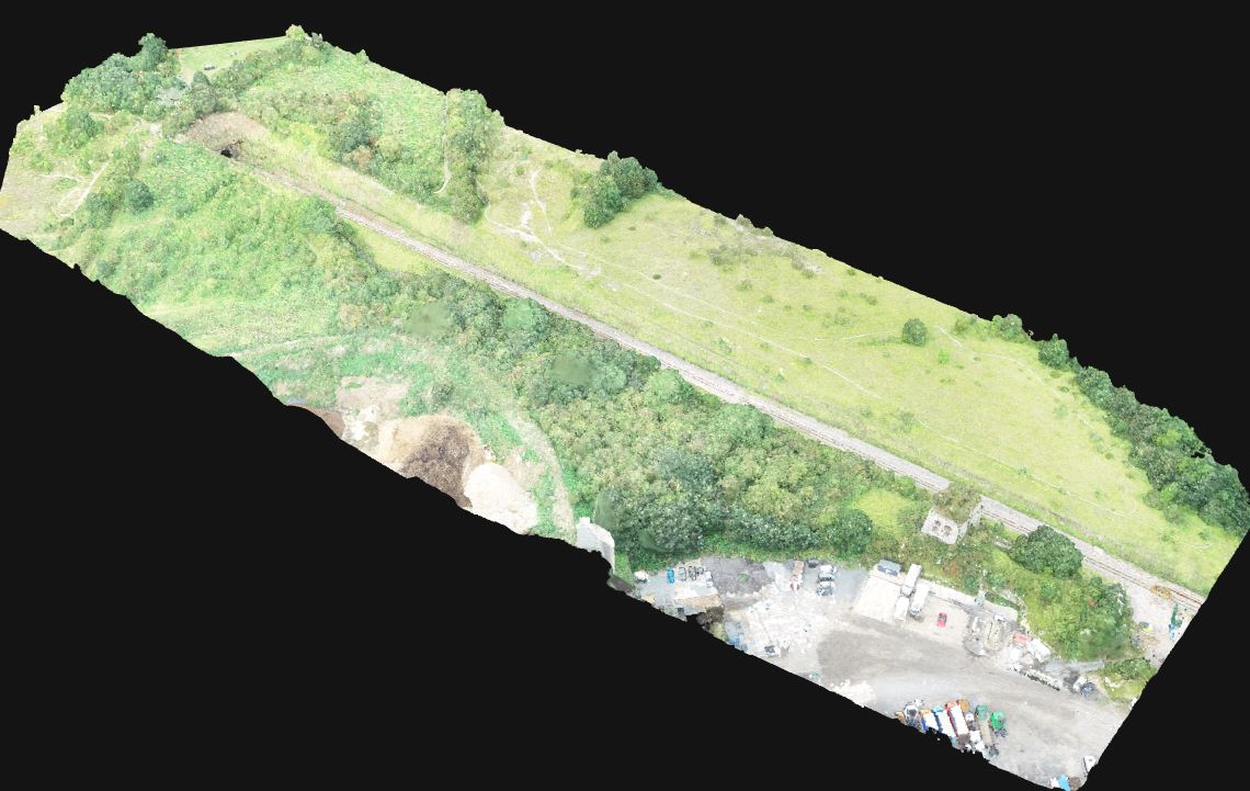 Above: 3D Model Below: 3D views of data captured along with plan Orthographic tiff image 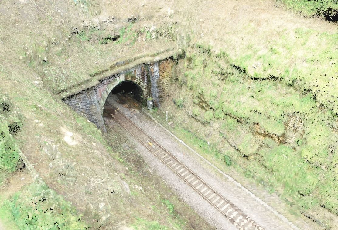 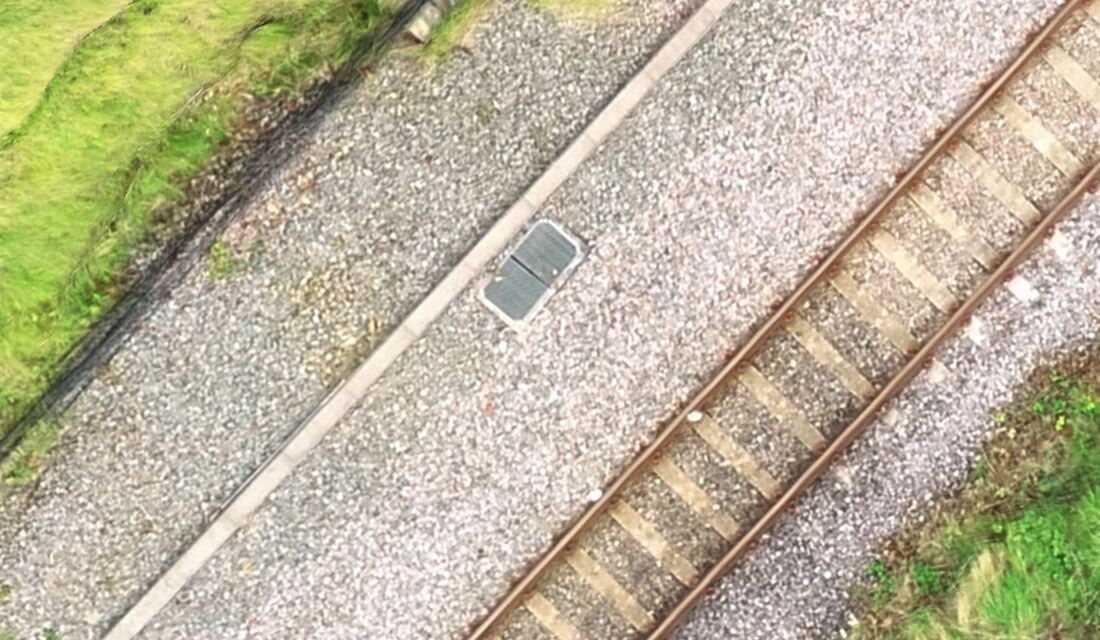 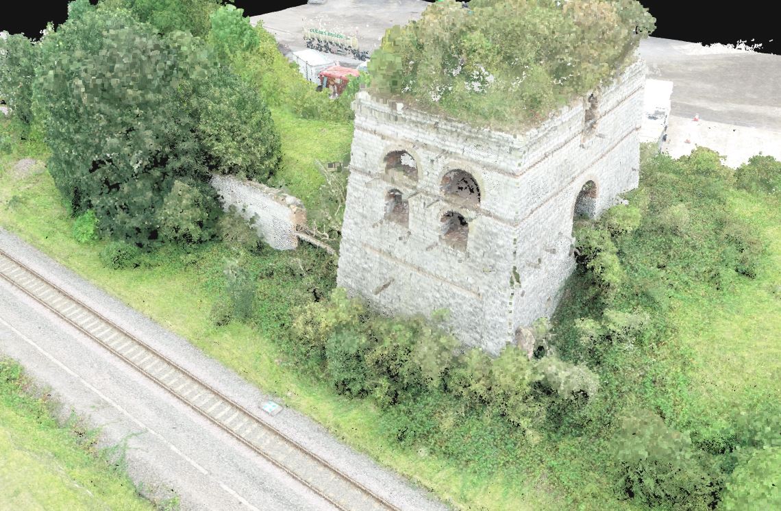 Protection of our coastal communities is an ongoing challenge. Hard engineering techniques including rock armour and concrete structures are used throughout the UK to deflect the power of waves, helping to reassure coastal communities and protect our beaches. Working with such structures carries many challenges and risks meaning that surveys are a vital step in any repair, renovation and improvement works. Back in 2017, working alongside Balfour Beatty and JBA Consulting, we were commissioned to provide survey works to assist in the repair and improvement of sea defences consisting of rock armour revetment and sea wall in East Rhyl. Revetments are sloped structures built along coastal frontages that absorb the energy of waves breaking against them, thus helping to reduce coastal risk. Rock armour involves placing large boulders in front of a cliff or sea wall to absorb the energy of waves. Used in conjunction these structures are a powerful means of energy absorption and protection. 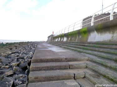 Our role as part of this project was to provide detailed topographical surveys with both 2d and 3d outputs compliant with BIM level 2 to inform the improvement works. 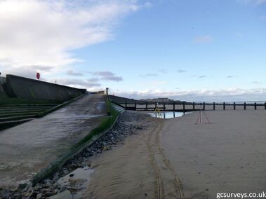 Using a combination of techniques including, GPS, total station and laser scanning we performed a mixture of high density and low density surveys as follows:
Whilst seaside working provides a beautiful setting, it also carries with it challenging weather conditions and lots of risk factors. Working near a tidal body of water meant that timing was of the essence, both in terms of survey accuracy and health and safety. Being November, we also had weather factors to contend with. During the course of the survey it was identified that the beach level change significantly between tides. An indication of which area of beach was surveyed each day was added to the final drawings Below: Laser scan data covering sea wall, rock armour and foreshore. Draft survey data showing areas of levels surveyed on individual days 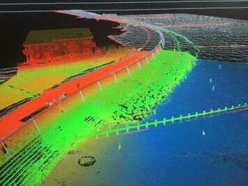 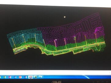 Below: 3D model generated from the laser scan alongside traditional total station promenade survey 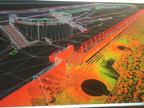 “Grantham Coates have been invaluable in supporting the development of a 3D model suitable for the construction of the East Rhyl defences. We were able to discuss through our requirements and explore relative advantages and disadvantages of different survey techniques. This meant that the deliverables provided by GCS met our needs and avoided any need for further post-processing.”
Alec Dane JBA Consulting To read more about out topographical survey work, click here. If you’d like to discuss a project of your own, contact us on 01789 764 420 or email info@gcsurveys.co.uk 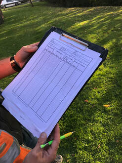 In April we posted on our Social Media channels that we were extremely proud of the results that Marcin, one of our Trainee Surveyors, was gaining on his TSA Surveying Training Course at The Survey School, and that prompted us to think about all the other training our team has undergone in order to do the job they do.
Now, as Surveyors there are lots of accreditations that we have to have in order to undertake the variety of work we are presented with, from working in water and working on the rail, to medicals and first aid. The most recent course we sent some of our team on was ‘Power Boat Handling’. Not surprisingly the most popular course so far…. We chose the ‘TSA Surveying Course for Surveyors’ qualification for Marcin for a number of reasons; one of which was that two of our employees also previously passed the course and found the experience invaluable, but also because the course is accredited by the Chartered Institution of Civil Engineering Surveyors, of which we are also members. Not only that, but the course is designed for trainee surveyors who already have a fair amount of experience surveying but no formal qualifications in the field, so Marcin was the perfect candidate. We think that Marcin would agree that although the course is going to provide him with the springboard he needs to progress in his career, it is not going to be easy. The course is designed to put trainee surveyors through their paces and prepare them for the varied world of surveying, so it covers a lot of topics in a lot of depth. However, if Marcin keeps progressing at the rate that he currently is (having just scored 94% in Block 4 Measured Building and Specialist Surveys) then we are confident he will finish the course a highly proficient and capable surveyor. To give you a further bit of insight, our surveyors are also trained in or hold the following accreditations:
So aside from actually conducting surveys, processing the collected data, producing the finished model and working to a tight deadline, our surveyors are also constantly keeping themselves up to date with the necessary skills and qualifications that our industry demands. Don’t let anyone ever tell you that the life of a Surveyor is an easy one! For the second edition in our Spotlight series, it’s all aboard for a whistle stop tour of our work in the rail industry. Rail work can incorporate many different types of surveys from surveying the rail infrastructure itself to the surrounding environments, including land and rivers. With experience across buildings, land and engineering, we are able to provide comprehensive rail surveys including:
Using the latest technology, both in the field and here at GCS HQ, we can provide accurate and detailed data for our clients. Our survey outputs include:
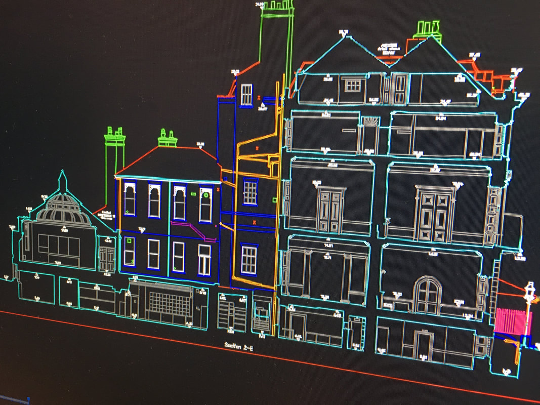
Being a RISQS (Rail Industry Supplier Qualification Scheme) approved company, we are a trusted supplier within the rail industry and are authorised to work on Network Rail infrastructure. Here’s what one of our clients had to say... “Grantham Coates Surveys have been providing our surveys for many years now - always innovating, always helpful, always approachable and always deliver to time and budget. Not only are they RISQS approved but also most of their staff are PTS trained and have many years’ experience of working in a railway environment. They have an approach and ethos to their work like no other and because of this they are reliable which, in a railway setting where time constraints are often tight, make them the ideal choice. We look forward to many more years of working together.” Iain Fox JBA Consulting If you’d like to talk to us about a rail project, contact us on 01789 764420 or info@gcsurveys.co.uk or for more information on our rail surveys click here. The first edition in our new Spotlight series! This month the spotlight is on measured building surveys. As land, engineering and building surveyors this is one of the key areas of our business. Measured building surveys is a diverse area which often sees us working alongside architects and developers on a variety of projects including houses of any size and shape, historic and listed structures as well as commercial buildings such as retail, offices, warehousing and agricultural.
No amount of technology will put our trusty tape measure into retirement, however we pair traditional tools with the latest technology to deliver top quality surveys for our clients.
Our experience, knowledge and technology allows us to deliver photographs, drawings and models but we don’t stop there. Our number one priority is client satisfaction so we also go above & beyond to ensure that all of our surveys that are fully layered with detailed annotations.
Don’t just take our word for it... “Chris, John and Grantham Coates Surveys have been our main supplier of measured building surveys for over seven years now, always with precise accuracy and attention to detail. They often deal with clients on our behalf and conduct themselves in a highly professional manner. I would happily recommend GC Surveys” Mark Powles RRA Architects To read more about our measured building surveys click here. To talk to us about a project of your own, contact us on 01789 764420 or info@gcsurveys.co.uk With the end of 2018 near, we are reflecting on some of our best bits! Here’s just a few of our highlights from this year…
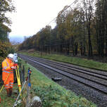
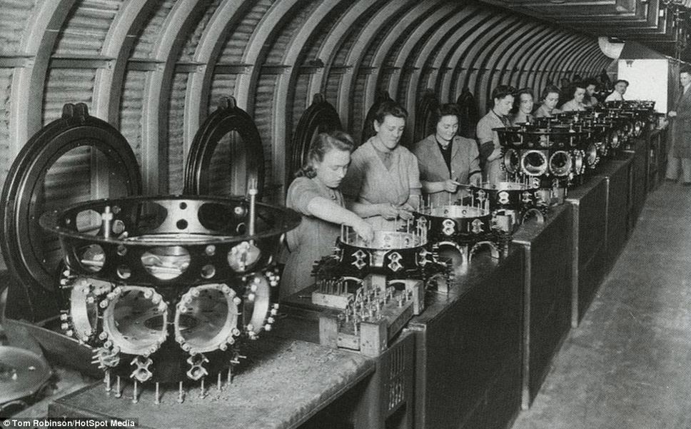
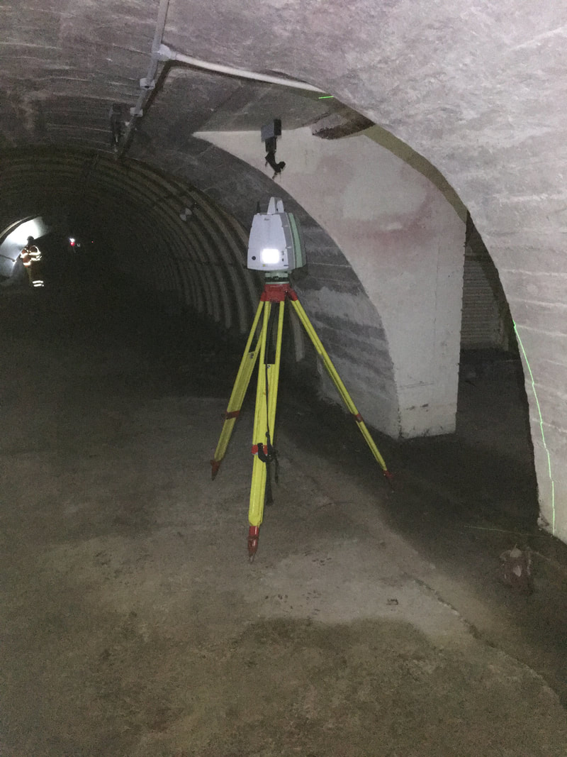
A bridge too far...never! In 2018 we have completed loads of railway bridge surveys including batches of 30+ in Wales and over 40 on London North Eastern line! Knowledge is power Surveying can take us to some hard to reach places, on land and water. This summer, Scott and Jack travelled to the Bristol Marine Academy for a two day course where they achieved their Powerboat licenses. This will enable them to access sites safely via the water when required. Well done both! Stepping back in time One of our favourite projects this year was a survey steeped in history. We were commission to obtain position level and gross volumes of two World War Two era tunnel complexes beneath the old Rover plant at Longbridge. Pictures below show then and now... Glitz and glamour There is no limit to the depths we will go to for a survey and a prime example of this is what is affectionately known in the office as ‘a poo pipe survey’. We are in the midst of scanning three chambers to ascertain the depth and alignment of an operational trunk sewer. Working below ground carries risks so the GCS team are all Confined Spaces trained. 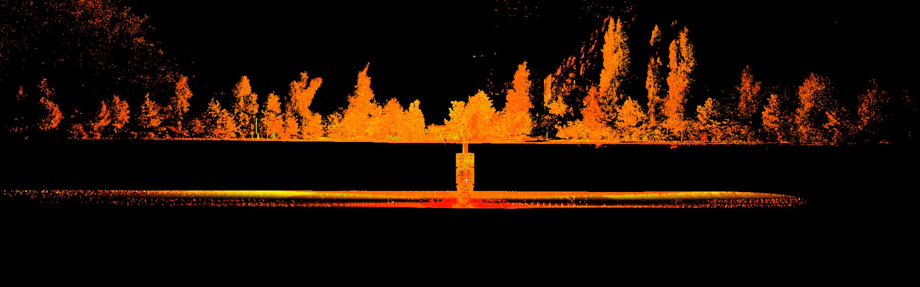
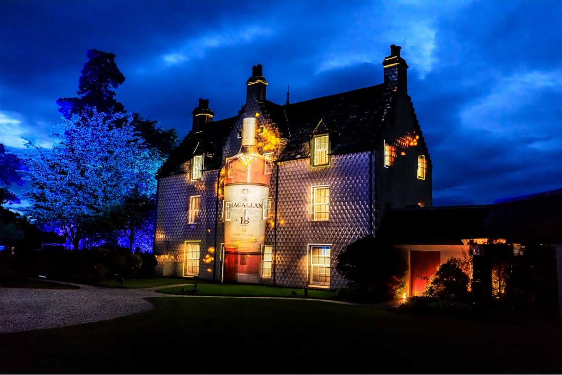
Near & Far We are often called upon to undertake laser scan surveys on areas that are going to be used for projection. Projection is a popular choice for large scale events and, working in conjunction with Projection Artworks, our laser scan surveys have been used to help the likes of Warwick Castle and The Macallan Distillery. At Warwick Castle, our survey was used to inform an epic projection-mapping of Guy of Warwick; The Dragon Slayer, defeating the Dragon! For our next projection project we travelled to bonnie Scotland for a two day survey helping Macallan prepare for the opening event of their £140million distillery!
Classified
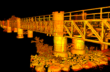
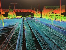
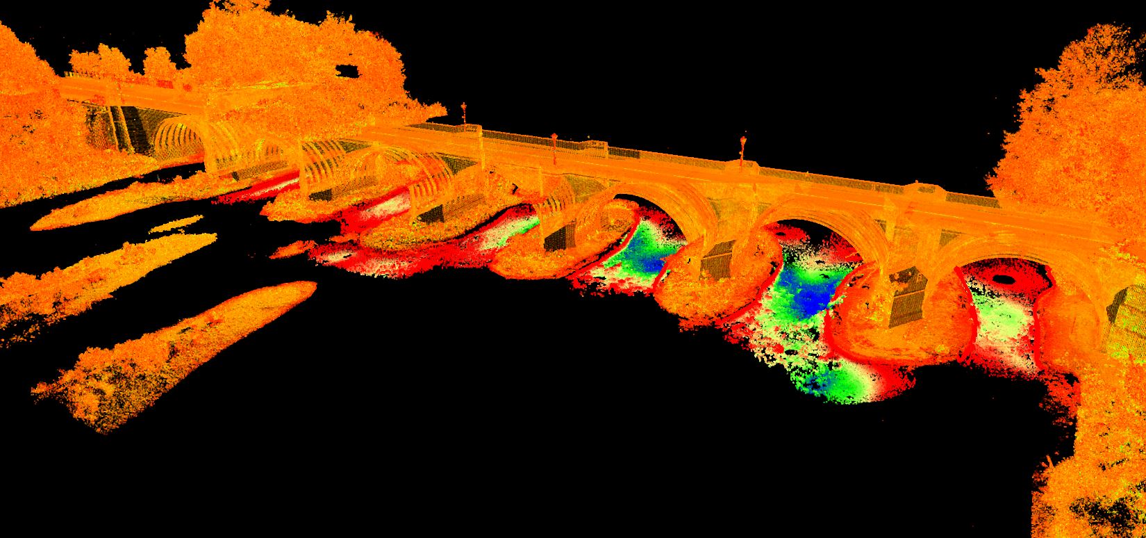
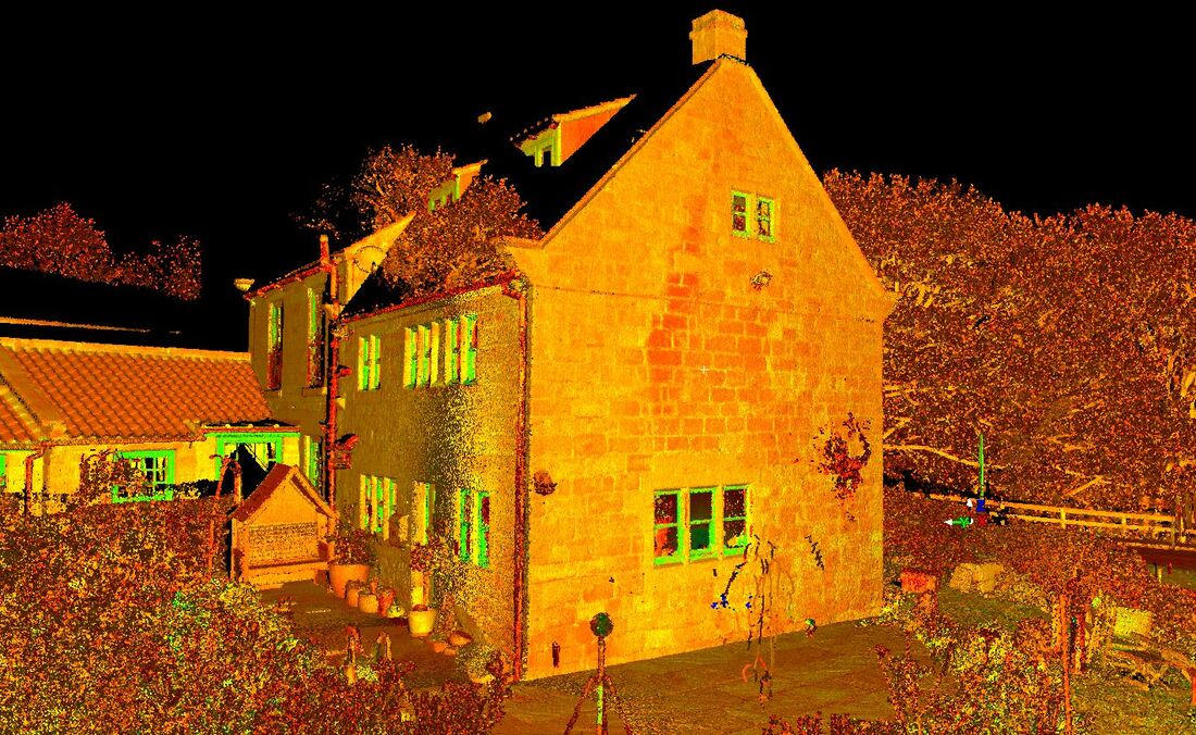
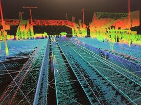
And finally a top secret highlight, we can’t disclose all of the details just yet but we undertook a huge topographical survey of 30+ hectares of forestry commission woodland, surveying every tree over 300mm! It was a four week project that involved the whole team on weekly rotations. Watch this space for more details! 2018 was a fantastic year and we can’t wait to see what 2019 brings! In the meantime, we’d like to wish all of our clients, suppliers and friends a very Merry Christmas and a Happy New Year. We look forward to seeing you in 2019. Earlier this year the Environment Agency warned that climate change was causing rising water levels and would therefore increase the risk of more frequent and dangerous flooding. These risks also pose a threat to infrastructure. There are thousands of railway bridges across the UK and one of the biggest threats to safeguarding our rail networks is the risk of scour affecting the bridge structures. Scour assessments have always been a vital tool in terms of monitoring and maintaining Network Rail infrastructure but this is becoming of increasing importance as predominantly Victorian engineering comes under threat from increasingly unpredictable weather and flood events. Here at GCS, we have many years experience providing scour assessment and scour protection surveys. For the scour assessment surveys, we provide our clients with elevation, cross section and long section information, enabling river modelling as part of the overall assessment. As you can see from the below images of a laser scan as part of a topographic scour protection survey, the detail we can get with a laser scanner is incredibly useful: 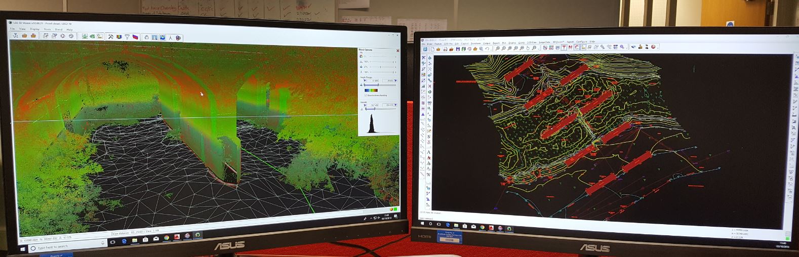 Performing a scour assessment survey allows the level of risk to be determined. The assessment delivers a low, medium or high rating. If the risk level is sufficiently high, we may then be asked to carry out a full scour protection survey. The scour protection survey delivers a high level of topographic and cross section detail to enable greater accuracy modelling as well as facilitating design of protection. Scour surveys, whether for assessment or protection, can be challenging for many reasons such as remote locations, access challenges as well as unexpected changes in water levels due to weather. Protection of our railway bridges is often overlooked by passengers but scour assessments are an on-going necessity to ensure the safety and sustainability of future railway services. To find our more about our work on rivers and railways, visit our services page. |
Grantham Coates Surveys
Land, Engineering & Measured Building Surveyors Archives
May 2020
Categories
All
Older Blogs
For older blog posts created before the launch of this new website please click the button below:
|

 RSS Feed
|
Grantham Coates Surveys Limited
2 Arden Court Arden Road Alcester Warwickshire B49 6HN |

|
© Grantham Coates Surveys Ltd